‘Let Water Go Where it Wants to Go’

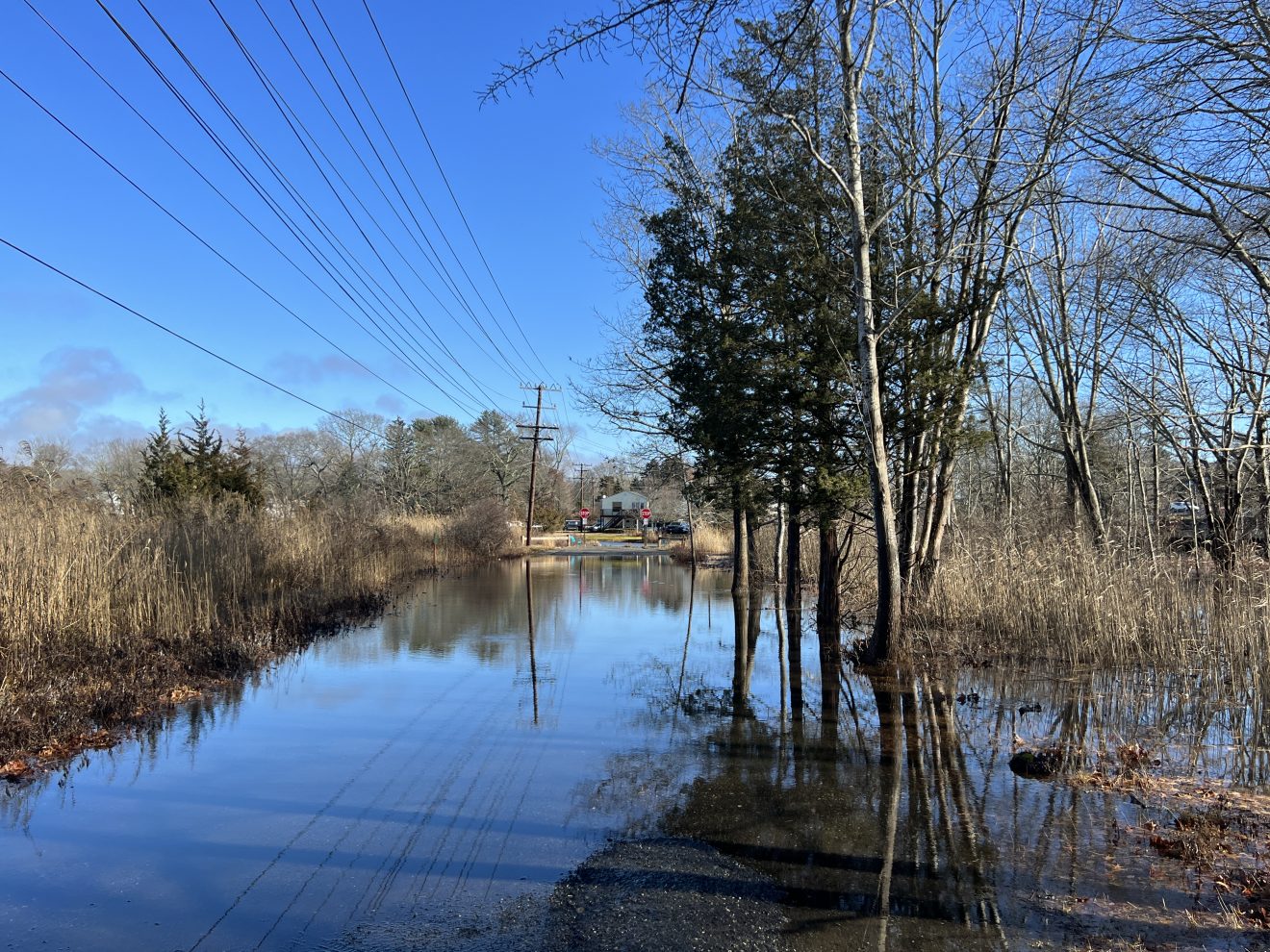
Jan. 13 flooding off Halls Road in Old Lyme (CT Examiner)

Share

TwitterFacebookCopy LinkPrintEmail

“Let water go where it wants to go,” Eric Sanderson warned readers of the New York Times, weeks after Hurricane Ida drowned nearly a dozen people in basement apartments in Queens, flooded Central Park and subways in Manhattan.

Sanderson, a conservation ecologist with a PhD, and a historian, had a point.

The basement apartments in Queens had been dug into wetlands, drained and filled a century ago, where Kissena Creek (now Kissena Park) met the Flushing River.

The flooded subway? That’s where a stream fed into Sunfish Pond.

“The city even has a map where the extreme flooding happens compiled from 311 reports and official observations,” wrote Sanderson, “It is, for all intents and purposes, a map of the old streams.”

It was Sanderson I had in mind a couple of weeks ago when heavy rains and a high tide combined to flood significant portions of Mystic. A foot-and-half of water on Cotrell Street. Flooding on Gravel, Holmes and Bay Streets. Water nearly onto Main Street as it crosses the lift bridge.

Mystic has inherited a multimillion-dollar problem with no easy answers.

Twenty miles to the west, Great Island and Calves Island had all but disappeared into the Connecticut River.

Off Halls Road in Old Lyme, wetlands on either side had reclaimed an abandoned roadbed slated as the spine of a $3 million project to build a bow bridge, park, and trail connecting new multifamily housing on Halls Road with the nearby historic district.

Hours after high tide, the roadbed remained submerged under the floodwaters.

I’ve heard some assurances that this flooding can be reduced or prevented by raised bulkheads on either side of the planned bridge abutments, which makes me wonder – even if true — is this a good thing? Or is Old Lyme instead adopting a frankly regressive approach to wetlands and local development, ironically, just feet away from the Roger Tory Peterson Estuary Center?

Detail of park, bridge and trail design (entirely within the flooded area)

Better, I think, is Essex where a plan is afoot to rebuild the marshes, and to soften rather than harden the shoreline to reduce flooding. There is a similar project off Fenwick.

For Old Lyme, perhaps, the better solution along Halls Road is to remove the abandoned roadbed, restoring and reconnecting the marshland, and instead re-engineering the Halls Road bridge to accommodate pedestrian traffic.

Let water go where it wants to go.