Share
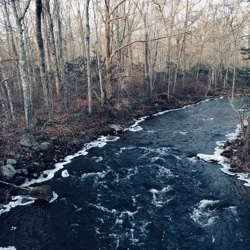
Trail cameras, like those used by hunters, are the latest tool for state water management staff to monitor disruption of Connecticut’s networks of streams.
The state Department of Energy and Environmental Protection has installed about 30 trail cameras across Connecticut to identify stream connectivity issues – areas where the flow of water is so low that a section of stream becomes impassable for fish.
Stream connectivity is key for migratory fish like the native brook trout, which spawn each fall in shallow riffle pools, and move to deeper waters as they grow, said Chris Bellucci an analyst for the department’s water monitoring program and the lead author of an August paper in the journal of Research and Applications detailing how water monitors use images from their network of trail cameras to identify impaired streams.
“Depending on the age of the fish, how big it is, where it is in its life, they have different requirements, and that’s why the whole stream network is important,” Bellucci explained. “If the stream becomes disconnected where they can’t get to certain areas, they could fail to spawn and not have any reproduction that year, or if it goes on consistently, they could just be separated from that stream.”
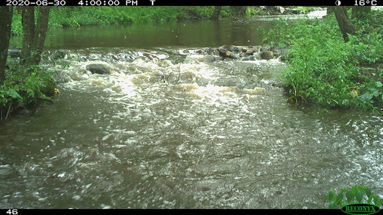
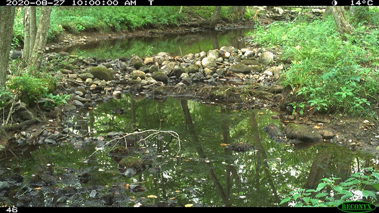
The cameras capture images of streams every hour. Some of the streams are known to have low flows, and others that have higher flows and are used as reference points. DEEP staff evaluate the photos for signs of impairment.
“We can take those images and turn it into data or metrics to describe what’s going on in the stream and how frequently it’s been dry – how many times a year it happened, how long the duration – so it provides really useful information,” he said.
The idea started in 2016 when staff went to photograph streams with handheld cameras, holding the cameras in the same spot every time. The next year, they purchased some trail cameras, realizing that would be the better way to do it long term.
“The neat thing about a trail camera is you don’t have to be there, you just leave it there and it’s collecting data for you,” Bellucci said. “Like this year, for example, was a very dry year, and we aren’t set up to drop everything we’re doing and go take pictures of all the streams.”
The U.S. Geological Survey has a system of stream gages that measure streamflow at 76 locations on rivers in Connecticut. That information is very valuable, but those gages aren’t in all the places that need to be monitored for stream connectivity – the small perennial streams that make up 86 percent of the stream miles in Connecticut and are key for cold-water species like the brook trout.
The gages are also expensive, about $20,000 to install and $15,000 a year to maintain. The trial system with seven trail cameras cost about $3,500 total, and trail cameras have been dropping in price since 2017.
Identifying flow-impaired streams
The paper published as a result of the team’s research includes 30 metrics to determine whether a stream is impaired for connectivity, which break down into measurements of how frequently there is a connectivity issue, how long flow is disconnected, the average flow of the stream and when in the year the stream is most disconnected.
Using those metrics, the state has been able to identify several miles of streams as being flow-impaired because of a lack of connectivity.
“You don’t want to put things on the impaired list when there’s not really an issue going on. You don’t want to underreport either, and I think in the beginning years we were probably underreporting a bit just because we want to be sure that something really has an issue with stream flow before we put it on the list,” Bellucci said. “But the cameras don’t lie. It makes the measurements, and now we have ways to quantify it better than we did two years ago, so we’re able to use technology to more definitively say the stream had impairment.”
There are generally three ways that people are impacting stream connectivity, he said. One is dams, of which there are thousands across Connecticut, and which can stop fish and disrupt stream flows. Another is culvert pipes that are meant to carry stormwater and connect streams under roadways, but some don’t stay submerged, so fish can’t pass through. Third is groundwater pumping, which can cause a stream to go dry, Bellucci said.
Belucci said the camera network was the first step, giving them a way to catalog and identify what streams have connectivity issues. The next step is a more thorough investigation into the sites to find out what’s causing the problems, and then to work with watershed advocates and dam permit holders to remedy the situation.
“The camera shows us something is unusual here that causes this stream to be disconnected more frequently than a reference stream in the area,” Bellucci said. “The next step is to do some investigation and figure out why is that and how can we get at this?”