Share
OLD SAYBROOK — After nearly five years of discussions and its formal nomination on June 5, 2018, the Shore Line Electric Railway Co. Powerhouse off Ferry Road in Old Saybrook, is now listed on the National Register of Historic Places.
“The importance of the national register listing is the recognition of its historical and architectural significance,” said Renee Tribert, the Making Places and Preservation Services Manager for the Connecticut Trust for Historic Preservation.
The property was previously identified as eligible for the State Register of Historic Places in 2015, as a result of a shoreline survey that was supported by phase two of a disaster relief assistance grant program established with federal funding after Hurricane Sandy. The second phase projects – totaling $4.1 million – focused on identifying vulnerable historic resources and resiliency planning to speed future disaster recovery efforts according to the State Historic Preservation Office.
The listing, which became official last week, will allow the town of Old Saybrook to apply for additional state and federal funding for efforts to redevelop Mariner’s Way, formerly Route 1 East.
“But what this means for any potential redevelopment or restoration can be huge, it opens up the possibility for state and federal funding,” Tribert said. “Where before anybody would have to find their own investors, now if they wanted to do rehabilitation or reuse to the standards of the secretary of the interior they can receive 25 percent state funding and 20 percent federal funding. This can be really important for a town.”
Old Saybrook’s Economic Development Commission led by Susie Beckman has been working to redevelop the business district near the historic power house since 2014, when a revitalization plan was adopted by the town.
The land identified for redevelopment as part of “Mariner’s Way,” is divided into three parcels. The first, stretches from 330 to 342 Boston Post Road, which the town has valued at $7.75 million. It is a 17.84-acre parcel, subdivided into 9 lots, with a single owner. The town has estimated the value of a second 1.76-acre parcel, 43-45 Mill Rock Road East, at $1.25 million. The land currently includes a restaurant, Som Siam. The last and smallest parcel, a .9-acre lot at 245 Boston Post Road includes 3,700 square foot office or retail building, and an estimated price of $600,000.
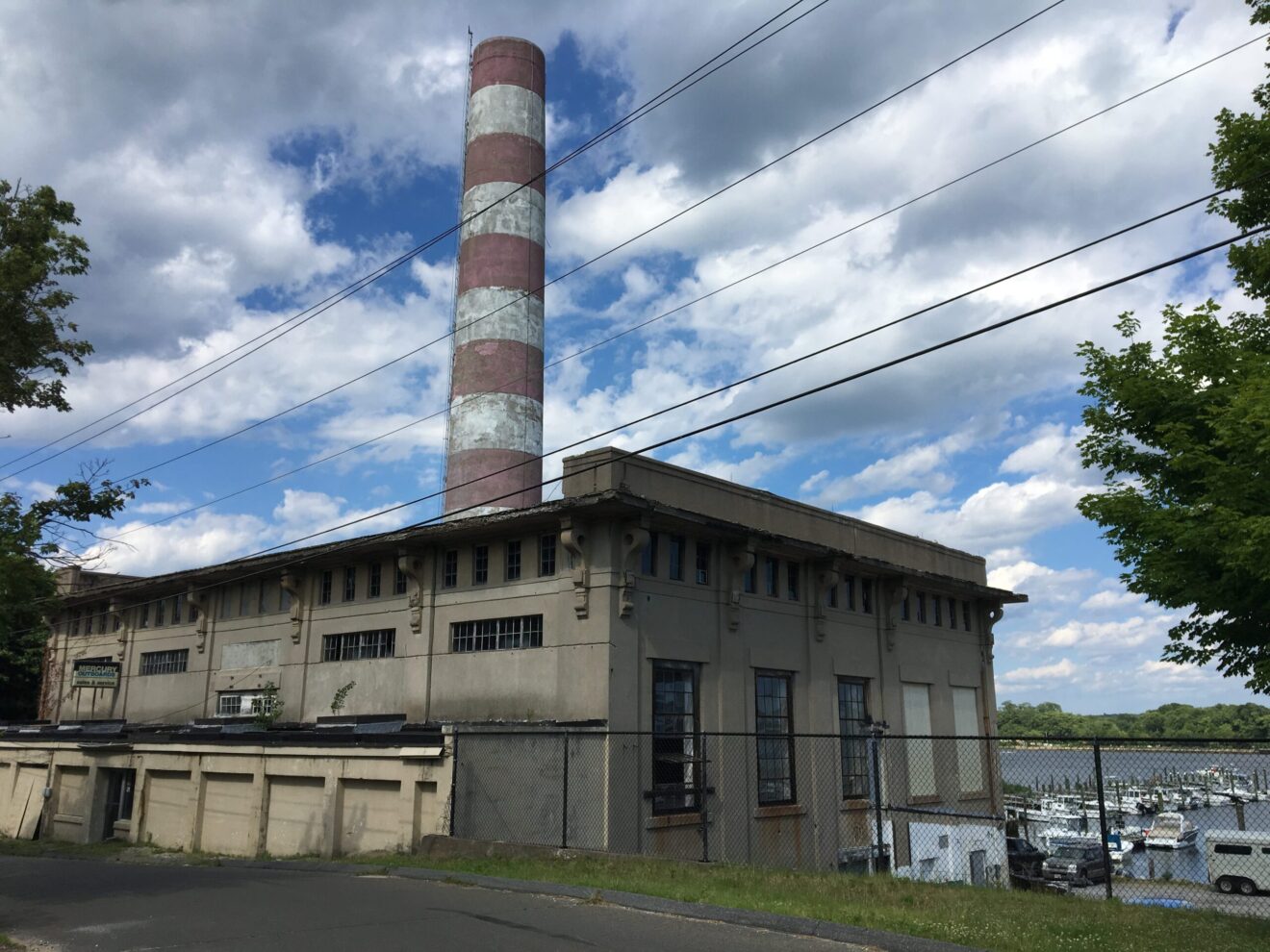
The powerhouse, which overlooks the marina, is made entirely of reinforced concrete topped with a large red and white smokestack making it an iconic landmark at the mouth of the Connecticut River. For a concrete structure it is really quite elaborate.
“It’s important to save on a couple of levels. Historically it was important for that early electric trolley line that linked the shoreline towns,” Tribert said. “It was an early means of providing transportation for people amongst these shoreline communities. This building supplied the power using coal in this plant and a series of substations provided power for the entire network.”

According to Tribert, after its trolley days the building was used as a warehouse by bootleggers during prohibition.
“This is an industrial building whose sole purpose was to create power but it was built to have some visual character,” Tribert said. “This one really is a little bit unique in the state of Connecticut.”